Interactive Maps

- Search by address or parcel number
- View data from many departments
- Print maps
GIS Quickstart - Step-by-Step Instructions
1. Data Layers
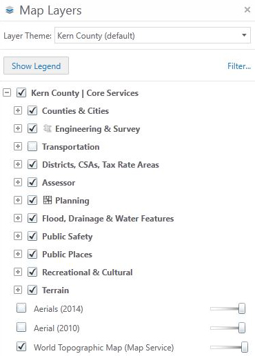 Data layers are displayed on the left side of the map in folders.
*Expand folders to see specific layers by clicking on the plus sign (+).
2. Additional Layers
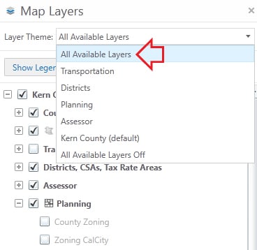 See additional layers by selecting All Available Layers from the Layer Theme drop down.
3. Planning
Expand and check the Planning folder to see all available data layers.

4. Check Desired Layer

Check the layer you wish to see.
*If a layer title is grey, it will not display at the current scale. You must zoom in or out to view it.
5. Property Location

Locate your property by clicking on the I want to...button located to the right of the map layers. Choose a search method.
6. Identify
View the details of any visible layers by clicking the Identify button on the toolbar. Then click an area on the map. A summary of results will display in a new tab over the map layers. Click on the blue links for further information.

7. Toolbar Utility
Explore the map by utilizing the toolbar.

*Available tools: measurements, plot coordinates, queries, add Google & Bing maps, and markups.
8. Additional Tabs
Various tools are available by clicking the tabs located above the toolbar.
